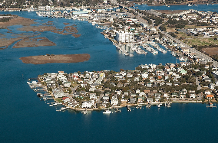
New preliminary floodplain maps could usher in more lenient flood zones and lower base flood elevations on Wrightsville Beach, but early reactions to the maps drew mixed responses from local authorities.
Wrightsville Beach Director of Planning and Parks Tony Wilson said the preliminary maps are an improvement from the effective maps, adopted in 2006.
“For me, it was a shock in 2006. When I reviewed the [preliminary] maps, I was pleased with some of the results. I was hoping in the Harbor Island area, we would see more decrease. … But overall, it’s pretty positive,” Wilson said.
Most of Harbor Island remains a VE zone on the preliminary maps, but base flood elevations drop one or two feet. The area around Town Hall shifts from VE, base flood elevation 15 feet, to AE, base flood elevation 13 feet.
Swaths of oceanfront property also switch from VE to AE zones on the preliminary maps, with elevation decreases as dramatic as four or five feet after the shift from VE, base flood elevation 14 feet, to AE, base flood elevation 11 feet.
Using Columbia Street as an example, Wilson said the elevation of the land in that stretch of the island is approximately 10 feet above sea level.
Spencer Rogers, construction and erosion specialist at N.C. Sea Grant, questioned whether the changes reflect damage historically endured by oceanfront properties.
Rogers recognized protection offered by substantial dunes on the south and north ends of the island, but said the U.S. Army Corps of Engineers’ Coastal Storm Damage Reduction (CSDR) project, which is the only coastal feature protecting oceanfront property in the center of the island, was designed to withstand a 50-year storm. He said many of the oceanfront properties did withstand wave action when Hurricane Fran swept onto the coast in 1996.
“The historic conditions of Fran appear to exceed the design of the preliminary maps, and are better reflected by the effective maps,” Rogers said during a Sept. 9 phone interview.
Rogers said changes to Harbor Island on the preliminary map do not reflect the impact of past storm events, either. He said during hurricanes Fran, and Floyd in 1999, the perimeter of Harbor Island endured the most damage but the interior of the island saw no wave action.
“Harbor Island had some of the most severe VE zones of anywhere in the state, and the damages around the perimeter of Harbor Island didn’t reflect the severity of the effective maps,” Rogers said. “The perimeter is more exposed to waves, obviously, so it should be higher risk. But the interior parts are so developed that one would think they would be less risky.”
Rogers said changes in base flood elevation for mainland areas adjacent to creeks, up by as much as three feet on the preliminary maps, also do not reflect historical impact.
Preliminary floodplain maps can be challenged during a 90-day public comment period. Wilson said the public comment period will begin after local authorities review the maps with officials from the N.C. Floodplain Mapping Program.
Successful challenges to preliminary floodplain maps require sound data, typically compiled by an engineering firm, and can be reimbursed for as much as $250,000 under the Homeowner Flood Insurance Affordability Act of 2014.
While money is available, the law also requires an interpretation by the Federal Emergency Management Agency. Rogers said in many past challenges under the Biggert-Waters Act, FEMA interpreted the law differently than engineers did.
“No one should assume off the top that they’re eligible for the $250,000 if they win,” he said. “It depends on how the law is interpreted. But there is a mechanism for appealing the maps.”
Despite the town’s concern about zones on Harbor Island, Wilson said he was not sure if the preliminary maps would be challenged in Wrightsville Beach since the island mostly saw decreases in zones and elevations.
Wrightsville Beach Town Manager Tim Owens agreed, saying the Board of Aldermen would ultimately decide if the town challenges the maps.
The maps are expected to be effective in 2015.
email [email protected]


