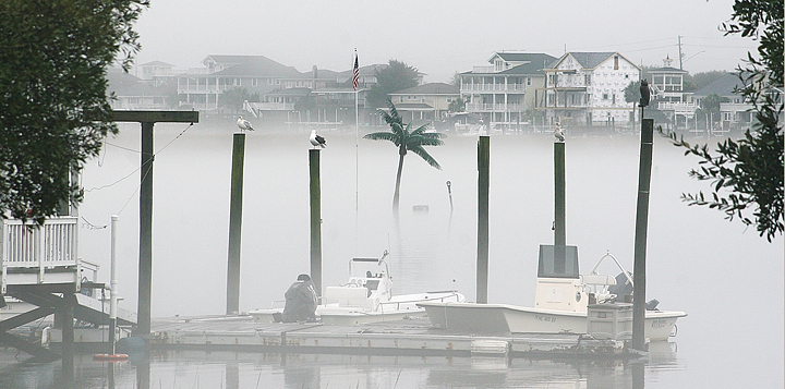
From heavy fog to a 70-degree January day to below-freezing temperatures, Wrightsville Beach welcomed the New Year with a string of fluctuating weather that includes a potential snowfall for this coming weekend.
The National Weather Service (NWS) in Wilmington on Wednesday announced that confidence has increased for an accumulating snowfall on the night of Friday, Jan. 6 and into Saturday morning for areas in southeastern North Carolina and South Carolina. The NWS said anyone with travel plans this weekend should monitor the weather for road conditions.
The snow forecast comes after a week of fluctuating weather. Humid conditions produced heavy fog on Monday, Jan. 2 and highs reached 70 degrees locally on Tuesday. But by this weekend, an Arctic air mass is forecasted to bring significantly colder temperatures, with wind-chill temperatures in the teens possible for Sunday and Monday.
“The rollercoaster of temperature will continue,” said Steven Pfaff, NWS warning coordination meteorologist.
However, Wrightsville Beach’s seaside conditions could help keep snow from reaching the beach, Pfaff said.
Pfaff said whether the beaches get snow from the storm is hard to predict, as it will depend on whether moisture accumulating by the shore stays close or is pushed offshore by a low-pressure front. If the moisture moves further offshore by the time the Arctic air mass reaches the Carolinas this weekend, then the possibility of snow for Wrightsville Beach could increase, while if the moisture stays close to the shore, it is more likely that any precipitation would turn into rain, he said.
While it is hard to predict whether Coastal Carolina will receive snowfall this weekend, Pfaff said NWS forecasters were increasingly confident that areas to the west would receive snowfall. Lumberton and Elizabethtown were both forecast to receive between 1 and 2 inches of snow.
“This far south, it’s harder to predict winter weather,” Pfaff said.
Looking back more than a century, Pfaff said that 41 percent of “bulk” snow events where more than three inches accumulated occurred in February, while 21 percent came in January.
“We’re heading into the peak season for winter storms,” Pfaff said.
Similar oceanside conditions are what contributed to the low visibility that coastal areas experienced on Monday, Jan. 2, with fog that rolled into Wrightsville Beach and other southeastern North Carolina towns in the early afternoon following heavy rains in the morning. The fog obscured visibility and cast a cloud over the town for most of Monday afternoon.
Pfaff said that “sea fog” is common for Coastal Carolina during these months. Wrightsville Beach Park Ranger Shannon Slocum described Monday’s fog as heavy, but not unusual.
Monday’s fog was the result of warm, moist air over the cool water of the ocean, Pfaff said.
Email [email protected]


